Ulla Ehrensvärd – Pellervo Kokkonen – Juha Nurminen
Mare Balticum
The Baltic – Two Thousand Years
Otavi Helsinki John Nurminen Foundation Helsinki
English translation Philip Binham
Main Photographer: Kaius Hedenström
Planned and produced by
John Nurminen Foundation, Helsinki
3rd edition
Copyright © 1995
John Nurminen Foundation, Helsinki
Otava Printing Works
Keuruu, Finland 1999
ISBN 951-1-13994-0

CONTENTS
(Comment by editor of this document: The titles of the main chapters without page numbers, although included in the table of contents, are not in the text itself, therefore they are set here in square brackets. Their subchapters, by the same author, are left-justified in the following table; included small articles by Juha Nurminen are right-justified and – in opposite to the original table-of-contents – located at its place in an overall consecutive page numberng.)
|
Title |
Author |
Pg. |
|
Acknowledgements |
|
5 |
|
|
|
|
|
THE BALTIC - AN IMAGE |
Matti Klinge |
10 |
|
|
|
|
|
[MARE BALTICUM - CULTURAL CROSS-SWELLS] |
Ulla Ehrensvärd |
|
|
Baltic Sea - Inland Sea |
|
12 |
|
Baltic geophysics and hydrography |
|
15 |
|
Ancient boats |
|
16 |
|
World as a globe |
|
17 |
|
Mare Balticum, Sinus Codanus, Ostsæ |
|
18 |
|
Wind-rose and compass |
|
24 |
|
The Baltic - a Closed Sea. Mare liberum - Mare clausum |
|
26 |
|
Connections with Ancient Mediterranean lands |
|
28 |
|
Mediterranean connections with the Baltic |
|
29 |
|
Vikings on the Road to the East |
|
31 |
|
Viking ships |
|
32 |
|
Viking road to the East |
|
35 |
|
The Varangian Sea in Arab cartography |
|
37 |
|
Missionary work, trade and piracy |
|
41 |
|
Black Heads |
|
44 |
|
Hanseatic League and Teutonic Knights |
|
48 |
|
Hansa cog |
|
50 |
|
Hansa connections |
|
52 |
|
Lübeck - Hanseatic Queen |
|
56 |
|
Sailing directions and Island books |
|
60 |
|
Baltic sailing routes of the Middle Ages |
|
62 |
|
Fishing |
|
68 |
|
Portolans |
|
70 |
|
Projection of sea charts |
|
82 |
|
Sounding |
|
84 |
|
Carta Marina and Carta Gothica |
|
85 |
|
Hulk |
|
88 |
|
Pilotage |
|
96 |
|
The oldest school of astronomy in the North |
|
98 |
|
Goniometry and latitude |
|
102 |
|
Sea marks |
|
108 |
|
Harbour equipment |
|
110 |
|
Dutch pioneers |
|
112 |
|
Flute |
|
116 |
|
Grain trade |
|
123 |
|
Johan Månsson's Sea Book and Chart |
|
124 |
|
Navigation skills in the Baltic |
|
127 |
|
Baltic work-horses |
|
131 |
|
The Gulf of Bothnia and the Staple Constraint |
|
132 |
|
Tar trade |
|
135 |
|
Mining products |
|
139 |
|
Sweden and Denmark as rivals |
|
140 |
|
Compass and magnetic phenomena |
|
146 |
|
Sea Atlas of Gedda and von Rosenfeldt, 1695 |
|
148 |
|
Shipbuilding |
|
156 |
|
|
|
|
|
[SPECULUM NAUTICUM - BALTIC MIRROR] |
Pellervo Kokkonen |
|
|
Speculum nauticum - birth of charting and early Baltic cartography |
|
161 |
|
Longitude and measurement of time |
|
164 |
|
Square-rigged ships |
|
166 |
|
Coastal defence |
|
174 |
|
Focus of charting shifts eastward |
|
177 |
|
Galley |
|
180 |
|
Farmer sailing ventures |
|
184 |
|
Russia Charts the Baltic |
|
188 |
|
Marine salvage and diving Operations |
|
192 |
|
Manufacture of instruments |
|
198 |
|
Measurement of speed |
|
201 |
|
Canals |
|
202 |
|
Sweden's charting developement projects and charting of archipelagoes |
|
206 |
|
Mail conveyance |
|
215 |
|
Private or public cartography? |
|
216 |
|
Lighthouses |
|
222 |
|
Timber |
|
227 |
|
Winter conditions in the Baltic |
|
228 |
|
Average winter maximum ice cover |
|
231 |
|
State cartography becomes established |
|
232 |
|
Merchant burghers' sailing ships |
|
236 |
|
Steam vessels |
|
244 |
|
|
|
|
|
[NAVIGATION, SHIPS, TRADE AND SEAFARING] |
Juha Nurminen |
|
|
[see above] |
|
|
|
|
|
|
|
[APPENDIX] |
|
|
|
Swedens's struggle for mastery of the Baltic |
Ulla Ehrensvärd |
248 |
|
Battles at sea |
Erik Wihtol |
250 |
|
Historie wrecks |
Juhani Grönhagen |
256 |
|
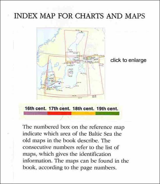
Index map for charts and maps |
|
261 |
|
List of maps, charts and pictures |
Nils-Erik Raurala |
263 |
|
Bibliography |
|
277 |
|
Index of persons |
|
284 |
pdf-Version
List of Maps, Charts and Pictures
Bereitgestellt durch:
Studienstelle Ostdeutsche Genealogie
(insbes. Pommern und Pommerellen)
der vorm. Forschungsstelle Ostmitteleuropa an der Universität Dortmund
Leiter:
Klaus-Dieter Kreplin, zum Nordhang 5, D-58313 Herdecke
Tel. [49] (0)2330 - 974294
E-mail: kdkreplin@studienstelleog.de
